

Simply put, to map an area is to appropriate it—to begin to bring it under control. Real maps represent a place’s temporal ‘geobody’ so to speak and help to self-craft a nation’s image. Treating maps and cartography as political practices, the physical space of a nation is ‘not merely space or territory’. It is a component of the life of a nation. It is a source of pride, loyalty, love or hatred.
In imperial times, China maps were called huayi tu or ‘maps of civilization and barbarism’. China was presented as centre of the world while foreign countries appeared small and insignificant. These maps consisted of a hierarchy of concentric circles—finally detailed at the imperial centre but very vague at the margins where the ‘barbarians’ resided.
In the early twentieth century, a new historical narrative arose around the idea of ‘100 years of national humiliation’. Highlighting their country’s history as a victim of foreign aggression led Chinese leaders to rely on what one academic calls ‘the moral authority of their past suffering’ and a cartography to match. Chinese atlases had ‘national humiliation maps’ to anchor in the public mind the danger of lost territories. Often these were ‘inside-out’ maps, with borders showing the extent of lost territory, and they played up fears of the country being once again ‘carved up like a melon’.
These maps were still used in key political events of the past twenty years. They appeared in textbooks after the 1989 Tiananmen crackdown, during the handover of Hong Kong in 1997 and during the sixtieth anniversary of China’s victory over Japan in World War II in 2005. Chinese foreign policy thus could be seen not as a security dilemma, but an identity dilemma. The maps reflect a positive–negative dynamic that intertwines China’s domestic and international politics. ‘Territorial integrity’, a constant phrase used by Beijing, is equivalent to ‘national identity’, thus the rapid response to the call for Hong Kong’s ‘independence’ by some in 2019.
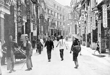
Prior to 1949 there were no border checkpoints between China and Hong Kong and people could move freely from one side to the other. In 1951 a ‘buffer’ zone known as the Frontier Closed Area was set up, a 28 sq km wire-fenced area along the border. However during the Cultural Revolution, a ‘touch base’ policy meant that mainland Chinese who made it to Hong Kong could stay. This policy remained in force until October 1980 (two years after China’s ‘open door’ policy). After the touch-base policy ended, a certain number of one-way permits a day were available to mainland Chinese.
Ethnic Chinese in Hong Kong could visit China with a permit called a ‘Home-Visiting Certificate for Compatriots from Hong Kong and Macau’ which resembled a passport. The word ‘home’ was used because Chinese migrants living in Hong Kong and Macau were travelling back to China which was their ancestral homeland.
In the period between the Sino-British Joint Declaration and the reversion to Chinese sovereignty on 1 July 1997, Hong Kong wanted to secure its freedoms as a ‘buffer’ against mainland China. The British colonial ‘text’ started to be gradually erased to make room for another text, the ‘one country, two systems’ text as embodied in the Basic Law. The geographical boundaries remained much as they had pre-transition; border checkpoints remained, the Frontier Closed Area was constantly patrolled and Hong Kong Chinese did occasionally make a ‘home visit’ the mainland to see relatives.
The British colonial administration began to ‘dehistoricise’ its connections with Hong Kong by ideologically shifting how it called its colonial possession, which was now a ‘territory’ rather than a ‘colony’. This change of name diluted the legitimacy of possible claims to Hong Kong’s future independence.
The Sino-British Joint Declaration and the Basic Law was seen as terms, the former being a ‘buffer’ against erosion of Hong Kong’s systems by the mainland while the Basic Law was seen as both a ‘bridge’ to the mainland, with a ‘wedge’ separating the mainland’s systems from Hong Kong’s. Governor Chris Patten focused on four main issues in order to create a myth that legitimised the so-called ‘British legacy’ to Hong Kong: a free market economy, freedom of the individual, and the rule of law and democracy, all of which were presented as self-evident truths and something that set it apart from China.
But large parts of Hong Kong are geographically part of the ‘mainland’. ‘Inner place’, the other term that Hong Kong people use to describe the rest of the country also indicates Hong Kong’s peripheral nature as a ‘gateway’ to it. The Closed Border Area remains in place, and permits from non-residents are still needed to enter it. Only on 15 February 2012 were some portions of land taken out of the Area, and 740 hectares opened for public access.
There is much movement (both personal and economic) between the two places, and the most heavily used immigration control point for passengers travelling to and from the mainland is the Lo Wu Bridge, a footbridge and steel railway truss bridge across the Shenzhen River linking Hong Kong to the rest of China.
‘One country, two systems’ was characterised by Beijing as encompassing a ‘high degree of autonomy’ and ‘Hong Kong People Ruling Hong Kong’. However, before its implementation, the ‘one country, two systems’ concept was only roughly sketched in the Basic Law, the latter being described as a ‘broad outline not a detailed map’.
However, the objective of the Basic Law was to ‘maintain the metaphorical and constitutional distance’ between China and Hong Kong, the desire of the former to ‘assert sovereignty and achieve unity’ became more apparent as time progressed. As Wittgenstein argues, problems with boundaries arise only if boundaries/borders are the major areas of concern. Ambiguous demarcation of borders leads to intractable border disputes between nations as history attests. One only needs to look at disputes between Israelis and Palestinians over Jerusalem and between India and Pakistan over Kashmir.
In 1989, Jiang Zemin famously quoted a literary saying, ‘The well water [Hong Kong] does not interfere with the river water [China]’ to explain that Hong Kong should not interfere in China and that China would also not interfere in Hong Kong. Metaphors of the Hong Kong–mainland arrangement of ‘one country, two systems’ after 1997 has been described as a tap, a hose, an embankment, and a ‘not insurmountable moat’.
Waters often mix, either accidentally or deliberately when man-made channels are dug or through storms or other natural phenomena. Hong Kong’s two main sources of water come from rainfall from natural catchments within its territory and from the Dongjiang River (East River) in Guangdong Province, so its waters do physically mix, but the metaphorical and constitutional distance between the sovereign entity and the Special Administrative Region has narrowed with the passing of the new security law.
![]()
More from Mekong Review
-
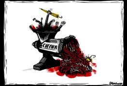
China crushes dissent in Hong Kong
-

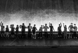
An activist’s detention marks the start of 4 June
-
Why the world should stand up to China’s assault on Hong Kong
- Tags: China, Free to read, Hong Kong, Jennifer Eagleton, Notebook